New images from an Indian ocean-studying satellite capture Earth’s continents and seas in stunning detail from space.
The Indian Space Research Organisation (ISRO) launched its Earth Observation Satellite-06 (EOS-06) to space last November. EOS-06 is the third spacecraft in India’s Oceansat series and is equipped with three science instruments that are designed to monitor sea surface temperatures and other ocean characteristics for at least five years.
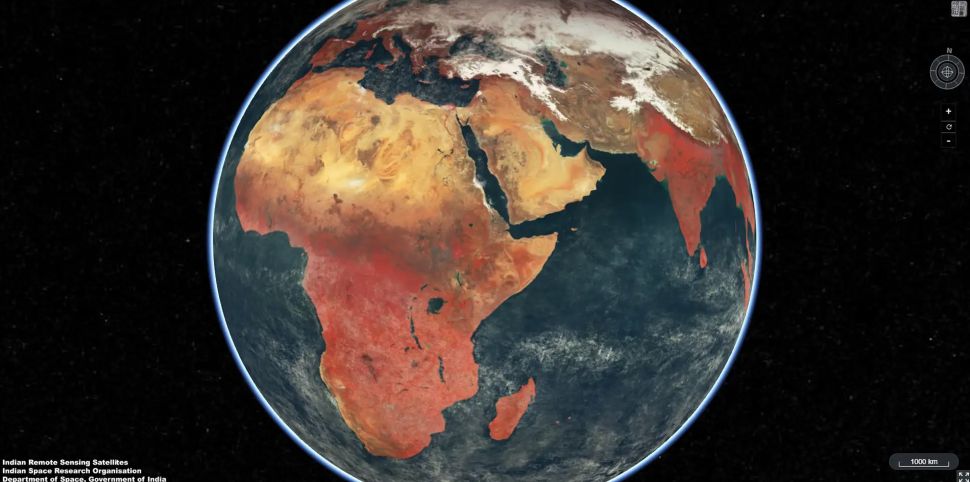
After processing 300 GB of data beamed back to Earth from the satellite, researchers created a false color mosaic image that combines 2,939 photos taken between Feb. 1 and Feb. 15, 2023. The images were taken using the satellite’s Ocean Color Monitor (OCM-3) instrument.

“OCM senses the Earth in 13 distinct wavelengths to provide information about global vegetation cover on Land and Ocean Biota for global oceans,” ISRO wrote on Twitter on March 29 (opens in new tab).
ISRO shared the new composite image (opens in new tab) online that same day. The images captured varying vegetation cover over Africa, Asia, North America, South America and Australia, with a spatial resolution of 0.6 miles (1 kilometer). The images are considered false color because the view of Earth is captured in wavelengths that would not be observed naturally by the human eye.


